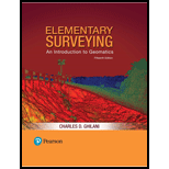
Elementary Surveying: An Introduction To Geomatics (15th Edition)
15th Edition
ISBN: 9780134604657
Author: Charles D. Ghilani
Publisher: PEARSON
expand_more
expand_more
format_list_bulleted
Concept explainers
Textbook Question
Chapter 1, Problem 1.1P
List 10 uses. for
Expert Solution & Answer
To determine
The list of ten uses for surveying in areas other than land surveying.
Explanation of Solution
The uses of surveying in areas other than land surveying are as follows
- Topographic surveys: A topographic survey is used to create maps of any location or areas by determining the elevations of all the natural as well as artificial features.
- Cadastral surveys: A cadastral survey is used to establish the property lines.
- Hydrographic surveys: The hydrographic surveying is also known as underwater surveying used to determine the depth of the water bodies, for determining and updating the nautical data which is used in navigating the oceans, and investigation of the marine environment.
- Astronomical surveys: Astronomical surveying is used to create an image of maps of celestial bodies and for determining the position of stars and planets.
- Aerial surveys: Aerial surveying is used to create the maps or images of any location by using the high-quality cameras fixed at the bottom of airplanes, helicopters or any other aerial bodies.
- Mine surveys: Mine surveying is done to determine the natural resources such as minerals and energy resources below the ground at greater depths.
- Satellite surveys: Satellite surveying is used to determine the position and altitude of any point with the help of satellites revolving around the Earth. For example, the GPS (Global Positioning System).
- Alignment surveys: Alignment surveying is used to create the maps and plans of linear projects. For example, railway, highways, sewer and pipelines and tunneling.
- Remote sensing: Remote sensing is the technique of determining the information of any geographical area by sensing the reflected relations using high-power sensing devices.
- Geographical information systems (GIS): The GIS is a computer system designed to collect, store, manipulate, and analyze the geographic data. This is done to create GIS-based maps. For example, google maps.
Conclusion:
There are many uses of surveying which are listed above.
Want to see more full solutions like this?
Subscribe now to access step-by-step solutions to millions of textbook problems written by subject matter experts!
schedule07:37
Students have asked these similar questions
List 10 uses for surveying other than property and construction surveying.
Elementary surveying
What situation does Astronomical Survey is applicable?
Chapter 1 Solutions
Elementary Surveying: An Introduction To Geomatics (15th Edition)
Additional Engineering Textbook Solutions
Find more solutions based on key concepts
The equation of elastic curve using the coordinate x and to specify the slope at point A and the deflection at ...
Structural Analysis (10th Edition)
The sub-surface profile at a certain site is shown in Figure 3.20. Compute and at Point A.
Figure 3.20
Soil ...
Foundation Design: Principles and Practices (3rd Edition)
What ingredients are used for the production of portland cement?
Materials for Civil and Construction Engineers (4th Edition)
The following is the first line of the copy constructor definition for the class StringVar. The identifier Stri...
Problem Solving with C++ (10th Edition)
For the circuit shown, find (a) the voltage υ, (b) the power delivered to the circuit by the current source, an...
Electric Circuits. (11th Edition)
Write a program that will search a file of numbers of type int and write the largest and the smallest numbers t...
Problem Solving with C++ (9th Edition)
Knowledge Booster
Learn more about
Need a deep-dive on the concept behind this application? Look no further. Learn more about this topic, civil-engineering and related others by exploring similar questions and additional content below.Similar questions
- Help pleaseee,fundamentals in surveying Research on the different types of tape used in measuring distances. Give at least three examples and indicate a brief description on it.arrow_forwardWhy survey controllers can be operated as electronic field books?arrow_forwardsurveying errors and mistakesarrow_forward
arrow_back_ios
arrow_forward_ios
Recommended textbooks for you
 Architectural Drafting and Design (MindTap Course...Civil EngineeringISBN:9781285165738Author:Alan Jefferis, David A. Madsen, David P. MadsenPublisher:Cengage Learning

Architectural Drafting and Design (MindTap Course...
Civil Engineering
ISBN:9781285165738
Author:Alan Jefferis, David A. Madsen, David P. Madsen
Publisher:Cengage Learning