1. Minimum path and min all necessary diagrams

Traffic and Highway Engineering
5th Edition
ISBN:9781305156241
Author:Garber, Nicholas J.
Publisher:Garber, Nicholas J.
Chapter12: Forecasting Travel Demand
Section: Chapter Questions
Problem 26P

Related questions

Question
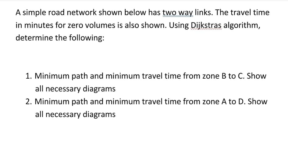
Transcribed Image Text:A simple road network shown below has two way links. The travel time
in minutes for zero volumes is also shown. Using Dijkstras algorithm,
determine the following:
1. Minimum path and minimum travel time from zone B to C. Show
all necessary diagrams
2. Minimum path and minimum travel time from zone A to D. Show
all necessary diagrams
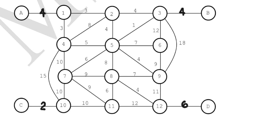
Transcribed Image Text:4
4
A
1
2
3
в
8.
1
3
4
12
4
7
18
5
6.
4
10
8
9.
15
7
8
4
10
11
10
12
C
10
11
12
D
6.
Expert Solution
This question has been solved!
Explore an expertly crafted, step-by-step solution for a thorough understanding of key concepts.

Step by step
Solved in 2 steps with 2 images

Knowledge Booster


Learn more about
Need a deep-dive on the concept behind this application? Look no further. Learn more about this topic, civil-engineering and related others by exploring similar questions and additional content below.Recommended textbooks for you
Traffic and Highway Engineering
Civil Engineering
ISBN:
9781305156241
Author:
Garber, Nicholas J.
Publisher:
Cengage Learning
Traffic and Highway Engineering
Civil Engineering
ISBN:
9781305156241
Author:
Garber, Nicholas J.
Publisher:
Cengage Learning