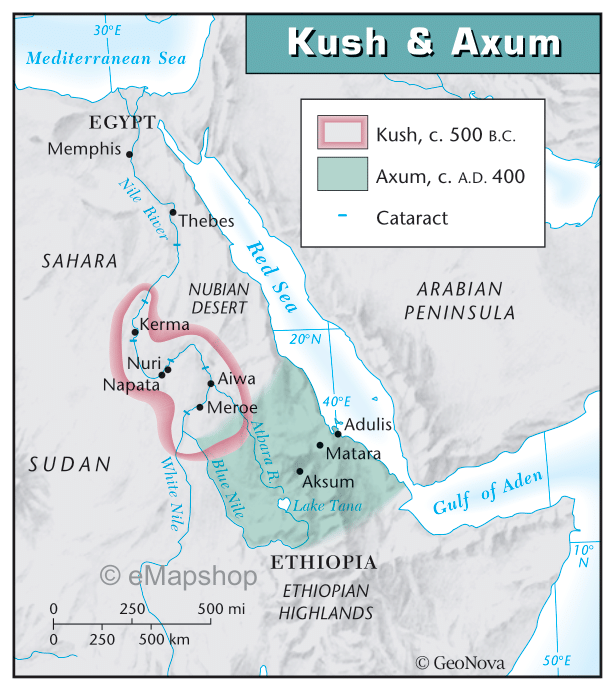
Briefly summarize the Kush & Axum map: - Title: Begin the summary by mentioning the title or a brief description of the map. This helps identify the map's subject matter. - Geographic Scope: Describe the geographical area covered by the map. This could be a specific region, city, country, or even a global perspective. - Key Features: Highlight the primary features depicted on the map. This could include physical features like mountains, rivers, or landmarks, as well as human-made elements such as roads, buildings, or infrastructure. In this map, talk about the cataracts - Timeframe: If the map represents data or information from a specific timeframe, specify it. This could be a specific year or period to provide context. - Conclusion: Wrap up the summary by reiterating the overall significance or importance of the map. Emphasize any implications or recommendations that arise from the map's content.

Briefly summarize the Kush & Axum map:
- Title: Begin the summary by mentioning the title or a brief description of the map. This helps identify the map's subject matter.
- Geographic Scope: Describe the geographical area covered by the map. This could be a specific region, city, country, or even a global perspective.
- Key Features: Highlight the primary features depicted on the map. This could include physical features like mountains, rivers, or landmarks, as well as human-made elements such as roads, buildings, or infrastructure. In this map, talk about the cataracts
- Timeframe: If the map represents data or information from a specific timeframe, specify it. This could be a specific year or period to provide context.
- Conclusion: Wrap up the summary by reiterating the overall significance or importance of the map. Emphasize any implications or recommendations that arise from the map's content.


Trending now
This is a popular solution!

Step by step
Solved in 3 steps
