Briefly summarize the Latin America, c. 800-1500s map

Related questions
Question
Briefly summarize the Latin America, c. 800-1500s map.
A summary of a map is a short overview of the main features and information that a map shows. A summary of a map should include:
- The title and purpose of the map
- The geographic area
- The main symbols and colors used on the map
- The key information or data that the map displays
A summary of a map should be written in your own words, using present tense and objective language. A summary of a map should not include:
- Your opinion or evaluation of the map
- Minor details or irrelevant information
- Direct quotes or copies from the map
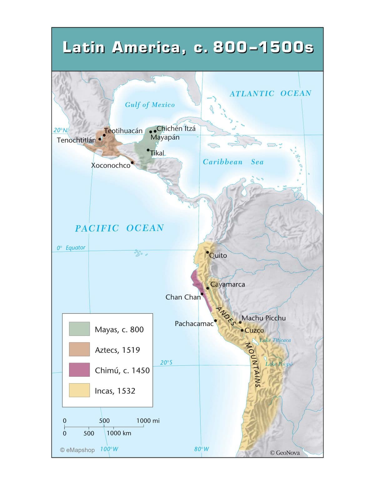
Transcribed Image Text:Latin America, c. 800-1500s
20°NS
Tenochtitlán
0° Equator
0
0
Gulf of Mexico
Teotihuacán..
Xoconochco
PACIFIC OCEAN
Mayas, c. 800
Aztecs, 1519
Chimú, c. 1450
Incas, 1532
500
Chichén Itzá
Mayapán
Tikal
500 1000 km
OeMapshop 100°W
1000 mi
Chan Chan
20°S
Quito
80° W
Caribbean Sea
Pachacamac
ATLANTIC OCEAN
M
ANDES
Qad
Cayamarca
Machu Picchu
Cuzco
Stre
MOUNTAINS
Lake Titicaca
Lake Poopó
80
D
© GeoNova
Expert Solution
This question has been solved!
Explore an expertly crafted, step-by-step solution for a thorough understanding of key concepts.

This is a popular solution!

Trending now
This is a popular solution!

Step by step
Solved in 3 steps
