1. Sketch and label areas of erosion and deposition resulting from the groin (top), jetty (middle), and breakwater (bottom) in these three maps: Land Seg Longshore current River Land Sea Longshare current Land Sea Longshore current
1. Sketch and label areas of erosion and deposition resulting from the groin (top), jetty (middle), and breakwater (bottom) in these three maps: Land Seg Longshore current River Land Sea Longshare current Land Sea Longshore current

Applications and Investigations in Earth Science (9th Edition)
9th Edition
ISBN:9780134746241
Author:Edward J. Tarbuck, Frederick K. Lutgens, Dennis G. Tasa
Publisher:Edward J. Tarbuck, Frederick K. Lutgens, Dennis G. Tasa
Chapter1: The Study Of Minerals
Section: Chapter Questions
Problem 1LR

Related questions
Question
Transcribed Image Text:unt.instructure.com/courses/34766/assignments/721720?module_item_id=D2081531
Continental margins occupy the perimeters of ocean basins where they meet the continents. Many continental margins exhibit three distinct segments: a shelf, slope, and
rise. Shelves (most landward segments) are flooded extensions of the continents. Slopes (middle segment) are steep as the name implies, and represent the approximate
boundary between oceanic and continental crust. The rise (most seaward segment) is a gradual descent to the deep basin.
Ocean basin floors consist of flat plains (called abyssal plains) dotted with seamounts and also include deep trenches. Seamounts are underwater volcanoes. Most seamounts
are extinct. Often they form at mid-ocean ridges (discussed below). Embedded in moving plates of lithosphere, seamounts migrate away from mid-ocean ridges and gradually
subside. Guyots are seamounts with flat tops, formed by waves eroding a volcano that once rose above sea level.
Ocean trenches are long narrow features of the ocean floor, which form where moving plates plunge into the mantle below. This setting is called a subduction zone. Trenche
are the deepest parts of oceans; the deepest trenches are approximately 11 km beneath sea level.
Extensive faulting and volcanic structures characterize mid-ocean ridges (sometimes called spreading centers). Plates on either side of a mid-ocean ridge spread apart from
one another. Mid-ocean ridges average about 1,300 km wide, with a 20-80 km wide central depression called the rift valley, a site of active volcanism. In some places, the
volcanoes extend above sea level to form islands such as Iceland.
Assignment
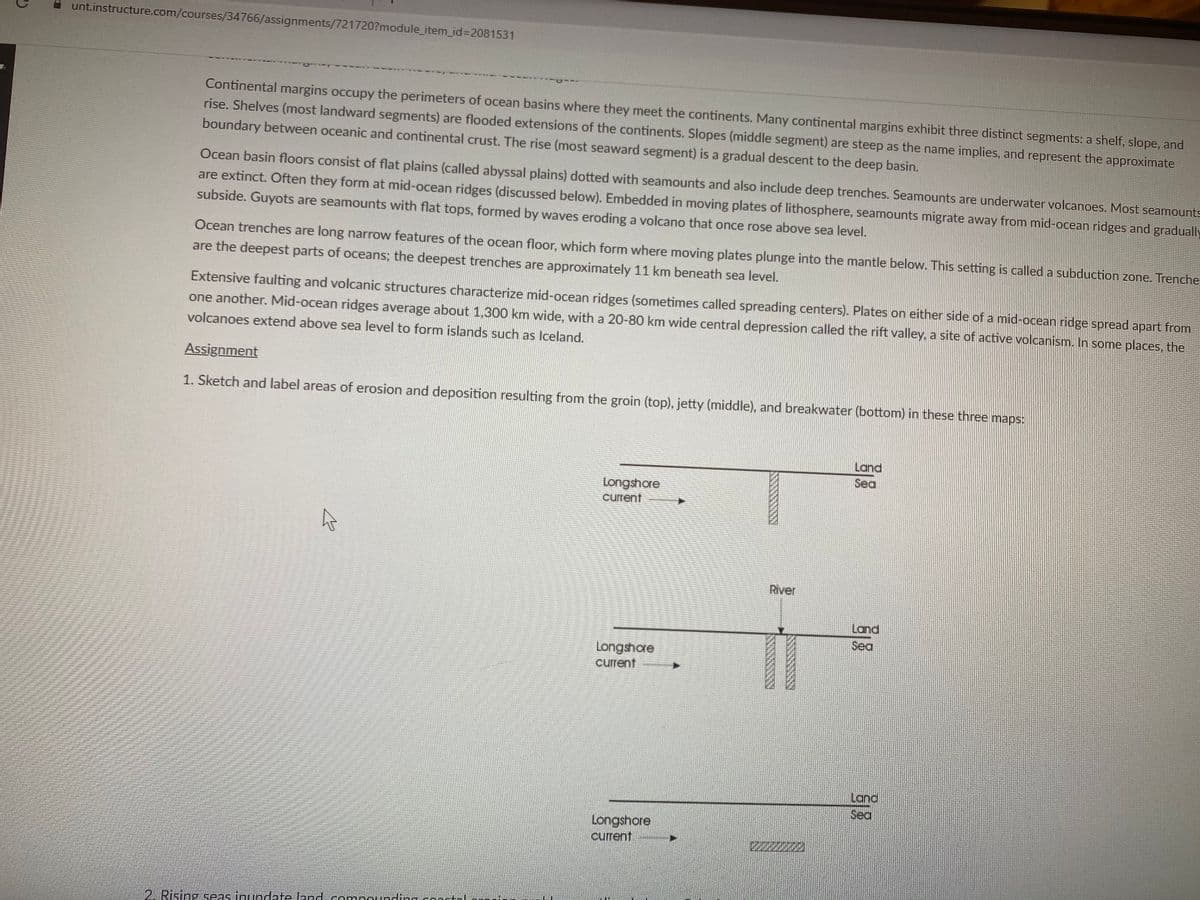
1. Sketch and label areas of erosion and deposition resulting from the groin (top), jetty (middle), and breakwater (bottom) in these three maps:
Land
Sea
Longshore
current
River
Land
Sea
Longshore
current
Land
Sea
Longshore
current
2220
2. Rising seas inundate Jand compounding conntoI
Expert Solution
This question has been solved!
Explore an expertly crafted, step-by-step solution for a thorough understanding of key concepts.

This is a popular solution!

Trending now
This is a popular solution!

Step by step
Solved in 2 steps with 1 images

Recommended textbooks for you
Applications and Investigations in Earth Science …
Earth Science
ISBN:
9780134746241
Author:
Edward J. Tarbuck, Frederick K. Lutgens, Dennis G. Tasa
Publisher:
PEARSON

Exercises for Weather & Climate (9th Edition)
Earth Science
ISBN:
9780134041360
Author:
Greg Carbone
Publisher:
PEARSON

Environmental Science
Earth Science
ISBN:
9781260153125
Author:
William P Cunningham Prof., Mary Ann Cunningham Professor
Publisher:
McGraw-Hill Education
Applications and Investigations in Earth Science …
Earth Science
ISBN:
9780134746241
Author:
Edward J. Tarbuck, Frederick K. Lutgens, Dennis G. Tasa
Publisher:
PEARSON
Exercises for Weather & Climate (9th Edition)
Earth Science
ISBN:
9780134041360
Author:
Greg Carbone
Publisher:
PEARSON
Environmental Science
Earth Science
ISBN:
9781260153125
Author:
William P Cunningham Prof., Mary Ann Cunningham Professor
Publisher:
McGraw-Hill Education

Earth Science (15th Edition)
Earth Science
ISBN:
9780134543536
Author:
Edward J. Tarbuck, Frederick K. Lutgens, Dennis G. Tasa
Publisher:
PEARSON

Environmental Science (MindTap Course List)
Earth Science
ISBN:
9781337569613
Author:
G. Tyler Miller, Scott Spoolman
Publisher:
Cengage Learning

Physical Geology
Earth Science
ISBN:
9781259916823
Author:
Plummer, Charles C., CARLSON, Diane H., Hammersley, Lisa
Publisher:
Mcgraw-hill Education,