Can all the questions be answered if possible. Thank you! What is the average speed at which Bna drifted away from the ridge at A during the past 67.7 Myr expressed in mm/yr? Show your work.
Can all the questions be answered if possible. Thank you! What is the average speed at which Bna drifted away from the ridge at A during the past 67.7 Myr expressed in mm/yr? Show your work.

Applications and Investigations in Earth Science (9th Edition)
9th Edition
ISBN:9780134746241
Author:Edward J. Tarbuck, Frederick K. Lutgens, Dennis G. Tasa
Publisher:Edward J. Tarbuck, Frederick K. Lutgens, Dennis G. Tasa
Chapter1: The Study Of Minerals
Section: Chapter Questions
Problem 1LR

Related questions
Question
Can all the questions be answered if possible. Thank you!
What is the average speed at which Bna drifted away from the ridge at A during the past 67.7 Myr expressed in mm/yr? Show your work.
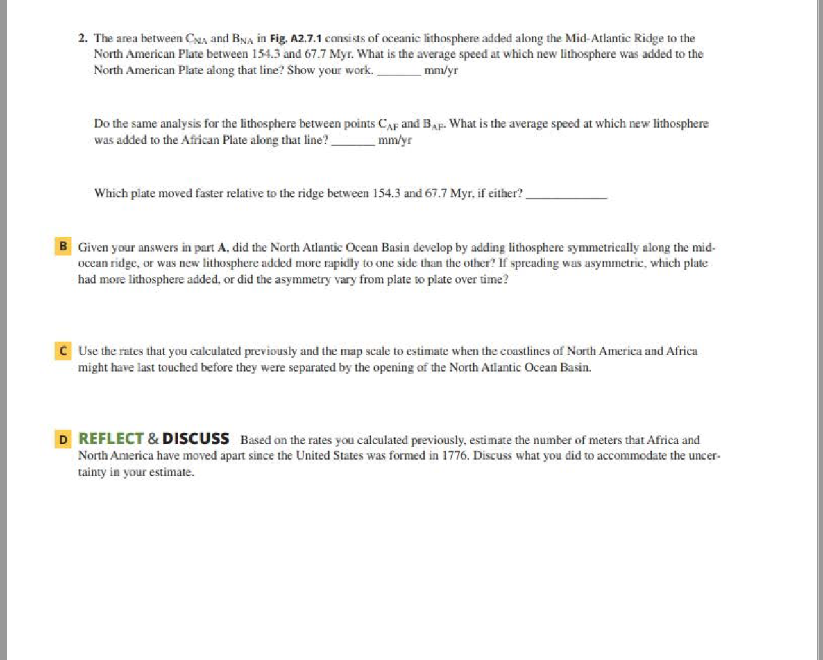
Transcribed Image Text:2. The area between CNA and BNA in Fig. A2.7.1 consists of oceanic lithosphere added along the Mid-Atlantic Ridge to the
North American Plate between 154.3 and 67.7 Myr. What is the average speed at which new lithosphere was added to the
North American Plate along that line? Show your work.
mm/yr
Do the same analysis for the lithosphere between points CAF and BAF- What is the average speed at which new lithosphere
was added to the African Plate along that line?
mm/yr
Which plate moved faster relative to the ridge between 154.3 and 67.7 Myr, if either?
B Given your answers in part A, did the North Atlantic Ocean Basin develop by adding lithosphere symmetrically along the mid-
ocean ridge, or was new lithosphere added more rapidly to one side than the other? If spreading was asymmetric, which plate
had more lithosphere added, or did the asymmetry vary from plate to plate over time?
C Use the rates that you calculated previously and the map scale to estimate when the coastlines of North America and Africa
might have last touched before they were separated by the opening of the North Atlantic Ocean Basin.
D REFLECT & DISCUSS Based on the rates you calculated previously, estimate the number of meters that Africa and
North America have moved apart since the United States was formed in 1776. Discuss what you did to accommodate the uncer-
tainty in your estimate.
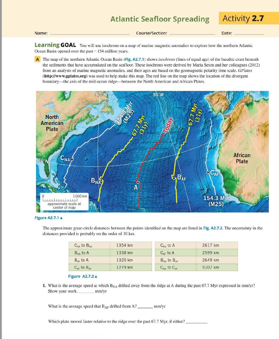
Transcribed Image Text:Atlantic Seafloor Spreading
Activity 2.7
Name:
Course/Section:
Date:
Learning GOAL You will use isochrons on a map of marine magnetic anomalies to explore how the northern Atlantic
Ocean Basin opened over the past - 154 million years.
A The map of the northern Atlantic Ocean Basin (Fig. A2.7.1) shows isochrons (lines of equal age) of the basaltic crust beneath
the sediments that have accumulated on the seafloor. These isochrons were derived by Maria Seton and her colleagues (2012)
from an analysis of marine magnetic anomalies, and their ages are based on the geomagnetic polarity time scale. GPlates
(http://www.gplates.org) was used to help make this map. The red line on the map shows the location of the divergent
boundary-the axis of the mid-ocean ridge-between the North American and African Plates.
60 W
30°W
North
American
Plate
CNA
African
Plate
30°N
CAF
BNA
BAF
1500 km
154.3 Мyr
(М25)
approximate scale at
center of map
Figure A2.7.1 A
The approximate great-circle distances between the points identified on the map are listed in Fig. A2.7.2. The uncertainty in the
distances provided is probably on the order of 10 km.
CNA to BNA
1354 km
CNA to A
2617 km
BNA to A
1338 km
CAF to A
2599 km
Bar to A
1320 km
BNA to Bar
2649 km
Сдr to Bar
1279 km
CNA to CAF
5107 km
Figure A2.7.2 A
1. What is the average speed at which BNA drifted away from the ridge at A during the past 67.7 Myr expressed in mm/yr?
Show your work.
mm/yr
What is the average speed that BAF drifted from A?.
mm/yr
Which plate moved faster relative to the ridge over the past 67.7 Myr, if either?
154.3 Myr
(M25)
67.7 Myr
(31y)
Today
67.7 Myr
(31y)
Expert Solution
Step 1
We’ll answer the first question since the exact one wasn’t specified. Please submit a new question specifying the one you’d like answered.

Trending now
This is a popular solution!

Step by step
Solved in 6 steps with 1 images

Recommended textbooks for you
Applications and Investigations in Earth Science …
Earth Science
ISBN:
9780134746241
Author:
Edward J. Tarbuck, Frederick K. Lutgens, Dennis G. Tasa
Publisher:
PEARSON

Exercises for Weather & Climate (9th Edition)
Earth Science
ISBN:
9780134041360
Author:
Greg Carbone
Publisher:
PEARSON

Environmental Science
Earth Science
ISBN:
9781260153125
Author:
William P Cunningham Prof., Mary Ann Cunningham Professor
Publisher:
McGraw-Hill Education
Applications and Investigations in Earth Science …
Earth Science
ISBN:
9780134746241
Author:
Edward J. Tarbuck, Frederick K. Lutgens, Dennis G. Tasa
Publisher:
PEARSON
Exercises for Weather & Climate (9th Edition)
Earth Science
ISBN:
9780134041360
Author:
Greg Carbone
Publisher:
PEARSON
Environmental Science
Earth Science
ISBN:
9781260153125
Author:
William P Cunningham Prof., Mary Ann Cunningham Professor
Publisher:
McGraw-Hill Education

Earth Science (15th Edition)
Earth Science
ISBN:
9780134543536
Author:
Edward J. Tarbuck, Frederick K. Lutgens, Dennis G. Tasa
Publisher:
PEARSON

Environmental Science (MindTap Course List)
Earth Science
ISBN:
9781337569613
Author:
G. Tyler Miller, Scott Spoolman
Publisher:
Cengage Learning

Physical Geology
Earth Science
ISBN:
9781259916823
Author:
Plummer, Charles C., CARLSON, Diane H., Hammersley, Lisa
Publisher:
Mcgraw-hill Education,